Copernical Team
Technicians apply foam to Artemis III
 Technicians at NASA's Marshall Space Flight Center in Huntsville, Alabama, apply the first round of spray foam as part of the thermal protection system to the launch vehicle stage adapter (LVSA) of NASA's SLS (Space Launch System) rocket for Artemis III. The cone-shaped element connects the rocket's core stage to its upper stage called the interim cryogenic propulsion stage and partially enclose
 Phantom Space selects Arnhem Space Centre for new dedicated launch site
 Phantom Space Corporation (Phantom), a space applications company providing small-class launch services to commercial and government clients has announced the selection of Arnhem Space Centre (ASC) on the Gove Peninsula in Australia's Northern Territory for a dedicated launch site.
The Arnhem Space Centre expands Phantom's space launch capabilities with direct access to very low-inclinatio
 Rocket Lab to take big step towards Electron reusability with pre-flown engine
 Rocket Lab USA, Inc. (Nasdaq: RKLB) is taking the next major step in evolving the Electron launch vehicle into a reusable rocket by launching a pre-flown Rutherford engine. The 3D printed engine, previously flown on the 'There and Back Again' mission launched in May 2022, has undergone extensive qualification and acceptance testing to certify it for re-flight, including multiple full mission dur
 SpaceX to make second bid to launch Starship on test flight
 SpaceX is to make a second attempt on Thursday to carry out the first test flight of Starship, the most powerful rocket ever built, designed to send astronauts to the Moon, Mars and beyond.
A planned liftoff Monday of the gigantic rocket was aborted less than 10 minutes ahead of the scheduled launch because of a pressurization issue in the first-stage booster.
The new window for liftoff
 Building telescopes on the moon could transform astronomy, and it's becoming an achievable goal

Lunar exploration is undergoing a renaissance. Dozens of missions, organized by multiple space agencies—and increasingly by commercial companies—are set to visit the moon by the end of this decade. Most of these will involve small robotic spacecraft, but NASA's ambitious Artemis program, aims to return humans to the lunar surface by the middle of the decade.
There are various reasons for all this activity, including geopolitical posturing and the search for lunar resources, such as water-ice at the lunar poles, which can be extracted and turned into hydrogen and oxygen propellant for rockets. However, science is also sure to be a major beneficiary.
The moon still has much to tell us about the origin and evolution of the solar system. It also has scientific value as a platform for observational astronomy.
Rare solar eclipse to cross remote Australia, Indonesia

European Space Agency chief eyes tapping private industry partners
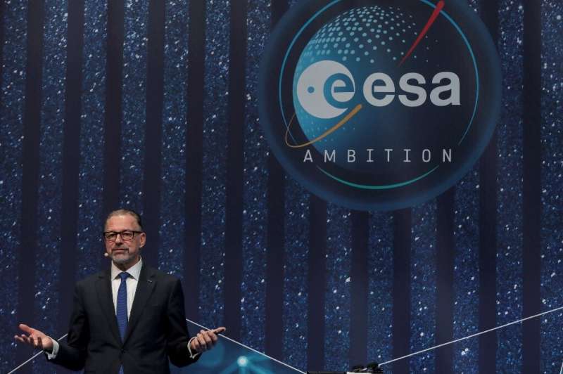
European Space Agency director Josef Aschbacher promised a "transformation" of the continent's space sector in the coming years during an interview with AFP, including more collaboration between government and private industry.
Private firms will be "encouraged to be a partner and not only a contractor," Aschbacher said, answering questions on the sidelines of an aerospace industry conference taking place this week in Colorado Springs, in the United States.
US space agency NASA has long incorporated private firms into its space exploration, planning to send its astronauts to commercial orbiting outposts once the International Space Station is retired.
But any major reorientation of the European space program will need to be discussed at the second European space summit, to be held in Seville, Spain, in November.
Here are Aschbacher's answers to questions posed Tuesday by AFP.
How much water do we use for irrigation?
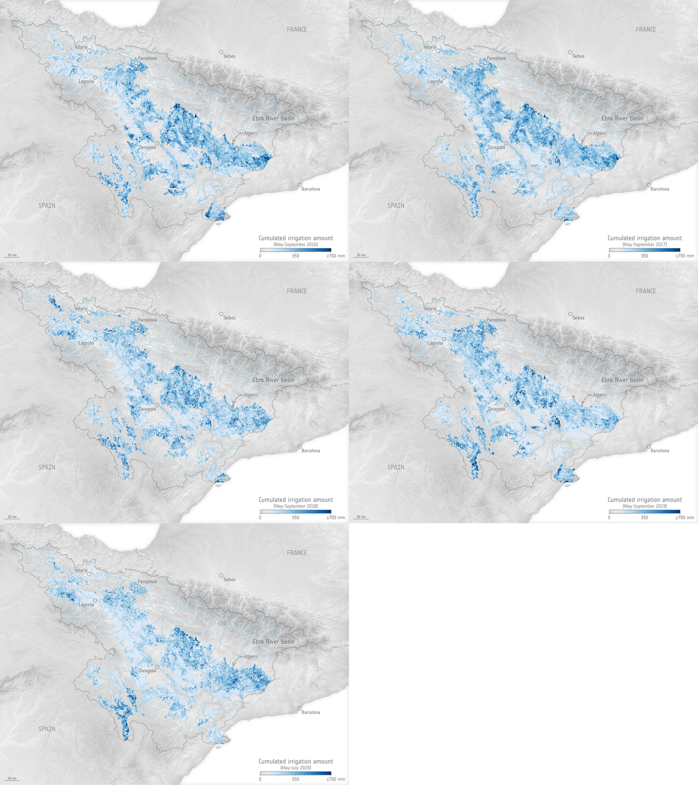
While we know that we use more water for irrigation than for any other single purpose, watering practices are not monitored worldwide. Water needed for agriculture is expected to further increase as time goes on, so managing this precious resource as effectively as possible is imperative. Scientists have now shown that a nifty way of using information from satellites could pave the way to measuring how much water we use to irrigate, which could subsequently lead to better management.
Smooth sailing, Euclid
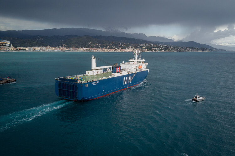
The Euclid satellite embarked on the next leg of the 1.5 million km long journey to space from where it will unlock the mysteries of the dark Universe.
Clouds for your eclipse? NASA experiment will fly kite to rise above

Imagine you traveled thousands of miles to see a total solar eclipse, but as the Moon began moving in front of the Sun, the sky grows cloudy, blocking your view of the unique celestial spectacle.
That's what happened to University of Hawaii astronomer Shadia Habbal—several times.
After traveling all the way to Antarctica on her latest expedition to study the inner part of the Sun's outer atmosphere—the corona—Habbal was met with clouds once again.


