Copernical Team
Arianespace and Orbex to explore European Launch Partnership
 Arianespace and Orbex, a UK-based provider of small satellite launch services, have signed a Memorandum of Understanding (MoU) to study possible future cooperation to answer its customers' requirements.
The agreement aims to increase the joint capabilities and flexibility of both partners' services. In particular, it is expected that future collaboration would be particularly beneficial fo
 Virgin Galactic's use of the 'Overview Effect' to promote space tourism is a terrible irony
 Virgin Galactic, the space tourism company founded in 2004 by Richard Branson, promotes its flights as offering:
A Brand New Perspective: Deepen your connection to Earth and to humanity with the transformational experience known as the Overview Effect.
First discussed in 1987 by space philosopher Frank White, the Overview Effect is a result of viewing Earth from space.
Expressi
 Opinion: Virgin Galactic's use of the 'Overview Effect' to promote space tourism is a terrible irony

Virgin Galactic, the space tourism company founded in 2004 by Richard Branson, promotes its flights as offering "a brand new perspective: Deepen your connection to Earth and to humanity with the transformational experience known as the Overview Effect."
First discussed in 1987 by space philosopher Frank White, the Overview Effect is a result of viewing Earth from space.
Expressions of the effect range broadly. Astronauts might experience profound awe and wonder at the perception of Earth as a fragile living being. Some suffer crushing grief when considering the harm humans inflict on nature.
NASA's Curiosity captures Martian morning, afternoon in new 'postcard'
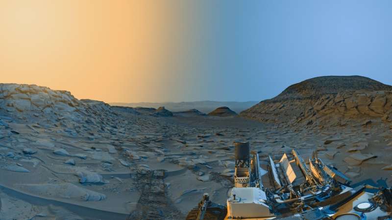
After completing a major software update in April, NASA's Curiosity Mars rover took a last look at "Marker Band Valley" before leaving it behind, capturing a "postcard" of the scene.
The postcard is an artistic interpretation of the landscape, with color added over two black-and-white panoramas captured by Curiosity's navigation cameras. The views were taken on April 8 at 9:20 a.m.
China is trying to stop its boosters from randomly crashing into villages
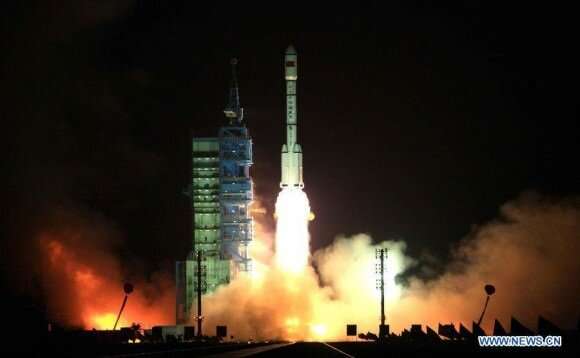
China's space program has advanced by leaps and bounds in a relatively short time. However, it has suffered some bad publicity in recent years due to certain "uncontrolled reentries" (aka crashes). On multiple occasions, spent first stages have fallen back to Earth, posing a potential threat to populated areas and prompting backlash from NASA and the ESA, who claimed China was taking "unnecessary risks." To curb the risk caused by spent first stages, China has developed a parachute system that can guide fallen rocket boosters to predetermined landing zones.
According to the Chinese Academy of Launch Vehicle Technology (CALT), which developed the system, the system was successfully tested on a Long March-3B (CZ-3B) rocket on Friday, June 9th. As they indicated in their statement, a review of the test data and an in-situ analysis of the debris showed that the parachute system helped narrow the range of the landing area by 80%.
Nanosats launched that use light to talk
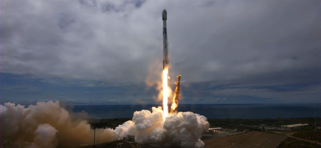
A second pair of satellites that use light to communicate with each other has been launched.
What's the dark matter with Euclid
 Euclid is ESA's mission to shed light on dark matter and dark energy, but teams at the Agency's mission control centre in Darmstadt, Germany, are also in the dark. A series of problems have befallen the mission in pre-launch simulations.
Currently about halfway through the Euclid simulations campaign, the key focus in the Main Control Room is the Launch and Early Orbit Phase (LEOP) and spa
 New keen-sighted satellite will view distant stars, assist Webb telescope
 NASA's James Webb Space Telescope (JWST), the most powerful telescope ever launched into space, will soon get a new "sidekick"-a small but nimble satellite that borrows its name from a multicolored sea creature.
Last month, NASA selected the $8.5 million space mission, which is called Monitoring Activity from Nearby sTars with uv Imaging and Spectroscopy (MANTIS). This "CubeSat," or mini-s
 USTC reveals reconfiguration process of solar eruptions
 Recently, a research team led by Prof. GOU Yanyu from the University of Science and Technology of China (USTC) of the Chinese Academy of Sciences (CAS) found that the solar outburst structure undergoes a complex reconfiguration evolution during the early outbursts, thus making important advances in the study of solar outburst activity. This study was published in Nature Astronomy.
In class
 Astrobotic and Westinghouse team to power outer space
 At the 2023 Keystone Space Conference last week, Westinghouse Electric Company and Astrobotic announced the signing of a Memorandum of Understanding to explore collaboration on space technology programs for NASA and the Department of Defense.
The collaboration will focus on the development of space nuclear technology and delivery systems. The joint effort will also include strengthening th


