Displaying items by tag: Landsat
Landsat Data Continuity Mission (LDCM)
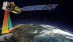
The Landsat Data Continuity Mission (LDCM) is the future of Landsat satellites. It will continue to obtain valuable data and imagery to be used in agriculture, education, business, science, and government.
The Landsat Program provides repetitive acquisition of high resolution multispectral data of the Earth's surface on a global basis. The data from the Landsat spacecraft constitute the longest record of the Earth's continental surfaces as seen from space. It is a record unmatched in quality, detail, coverage, and value.
The LDMC satellite is scheduled to b e launched in 2013.

Earth Resources Technology Satellite
Landsat
The Landsat program is the longest running enterprise for acquisition of satellite imagery of Earth.
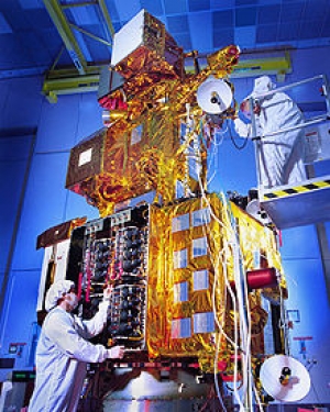
On July 23, 1972 the Earth Resources Technology Satellite was launched. This was eventually renamed to Landsat.
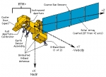
The most recent, Landsat 7, was launched on April 15, 1999. The instruments on the Landsat satellites have acquired millions of images. The images, archived in the USA and at Landsat receiving stations around the world, are a unique resource for global change research and applications in agriculture, cartography, geology, forestry, regional planning, surveillance, education and national security.