Displaying items by tag: space weather
NOVELTIS
The NOVELTIS company performs innovative scientific engineering studies and implements customised end-user solutions in the fields of Space, the Environment and Sustainable Development.
Our scientists develop high-tech solutions that involve top-level skills in environmental and physical sciences, in domains covering the atmosphere, oceans, and land surfaces.
The NOVELTIS staff is expert in modelling, simulations, processing of observation data and measurements, information systems, impact assessments, decision support systems...
NOVELTIS’ range of services includes:
- Preliminary studies of new mission concepts;
- Development and exploitation of end-to-end simulators;
- Specification and analysis of the performance of observation instruments and space missions;
- Design and development of geophysical products derived from such missions;
- Validation of observation products and mission calibration.
NOVELTIS’ positioning in environmental applications based on space data-derived information, enables us to offer different approaches for the design and valorisation of space products.
NOVELTIS’ added value lies in the synergy between its expertise in space science and technology, and its skills in environmental science and its applications.
NOVELTIS plays a significant part in the preparation of future missions or innovative measurement concepts in various domains of Earth Observation:
- Meteorology and atmospheric sounding with IASI-NG and MTG/IRS;
- Atmospheric chemistry and air quality with Sentinel-4 and Sentinel-5;
- Climate and greenhouse gases with GOSAT and Microcarb;
- Oceanography and continental hydrology with AltiKa, Sentinel-3 and SWOT;
- Ocean biogeochemistry and vegetation with multispectral and hyperspectral programmes such as SPECTRA and HypXim;
- Glaciology with observing techniques such as P-band ground penetrating radars or lidars.
Since its creation, NOVELTIS has been deeply involved in the implementation and exploitation of atmospheric sounding space missions such as IASI.
We have been or are taking part in Jason-1 and Jason-2 altimetry missions, MERIS data processing development for vegetation measurement, and GRACE (measurement of the Earth gravity field).
SSA, Space Situational Awareness
The ESA SSA Programme aims, ultimately, to enable Europe to autonomously detect, predict and assess the risk to life and property due to man-made space debris objects, reentries, in-orbit explosions and release events, in-orbit collisions, disruption of missions and satellite-based service capabilities, potential impacts of Near-Earth Objects (NEOs), and the effects of space weather phenomena on space- and ground-based infrastructure.
The objective of the SSA programme is to support Europe's independent utilisation of, and access to, space through the provision of timely and accurate information and data regarding the space environment, and particularly regarding hazards to infrastructure in orbit and on the ground.
In general, these hazards stem from possible collisions between objects in orbit, harmful space weather and potential strikes by natural objects, such as asteroids, that cross Earth’s orbit.
ESA's SSA programme is focusing on three main areas:
- Space Weather (SWE): monitoring conditions at the Sun and in the solar wind, and in Earth's magnetosphere, ionosphere and thermosphere, that can affect spaceborne and ground-based infrastructure or endanger human life or health.
- Near-Earth Objects (NEO): detecting natural objects that can potentially impact Earth and cause damage
- Space Surveillance and Tracking (SST): watching for active and inactive satellites, discarded launch stages and fragmentation debris orbiting Earth.
Each of these activities is being developed as 'segment' (analogous to a satellite's traditional 'ground segment') in parallel sets of capabilities and services, supported by data centres and a Tasking Centre with contributions by existing European infrastructure.
GOLD mission
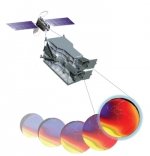
The mission, known as the Global-scale Observations of the Limb and Disk, or GOLD, involves imaging Earth's upper atmosphere from a geostationary orbit some 22,000 miles above the planet.
The mission is expected to have a direct impact on the understanding of space weather like geomagnetic storms that alter the temperature and composition of Earth's atmosphere, which can disrupt communication and navigation satellites, affecting everything from automobile GPS and cell phone coverage to television programming.
The GOLD mission is part of NASA's new Heliospheric Explorer Program designed to provide space observations to study Earth's ionosphere and thermosphere. The mission is slated for launch in 2017.